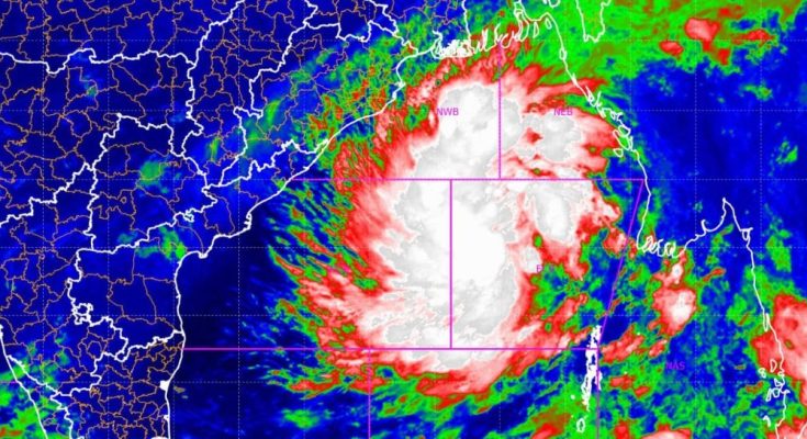
Cyclone Big Update: The deep depression over Bay of Bengal has turned into a cyclone storm today. It is now 560 km away from the Paradip Odisha and 630 km away from Sagar Island. It is moving towards at a speed of 18 km per hour. This storm will develop into a severe storm and make landfall tomorrow. At this time, the wind speed is expected to be 100 to 110 km per hour.
It was earlier informed that it will take the form of cyclone on 23rd. Then on 24th, it will touch the land in the form of a strong cyclonic storm. It will cross somewhere between Puri and Sagar Island, the Meteorological Department said.
Odisha SRC office said that, ‘deep depression over Eastcentral Bay of Bengal moved west-northwestwards with a speed of 18 kmph during past 6 hours intensified into a cyclonic storm “ *DANA” (pronounced as Dana), and lay centred at 0530 hrs IST of today, the 23rd October, over the same region near latitude 16.3° N and longitude 89.9°E, about 560 km southeast of Paradip (Odisha, 630 km south-southeast of Sagar Island (West Bengal) and 630 km south-southeast of Khepupara (Bangladesh).
It is very likely to move northwestwards and intensify into a severe cyclonic storm over northwest Bay of Bengal by early morning of 24th and cross north Odisha and West Bengal coasts between Puri and Sagar Island during night of 24th to morning of 25th October, 2024 as a severe Cyclonic Storm with a wind speed of 100-110 kmph gusting 120 kmph.


